Dear WeatherCat climate watchers,
Apologies for the delay, but here at last is the first 1 month and 3 month forecasts from the National Weather Service -
Climate Predication Center for the start of Autumn. Before we get to the actual graphs, it is worth noting that NOAA has issued their 2024-25 winter outlook which is based largely on these forecasts:
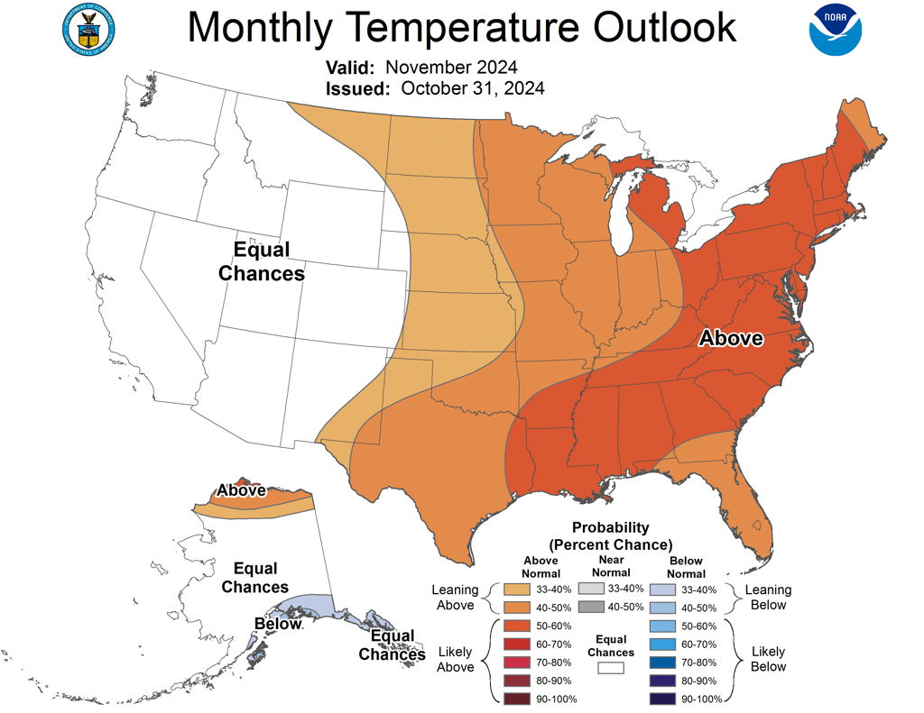
https://www.noaa.gov/news-release/us-winter-outlook-warmer-and-drier-south-wetter-northHere is the one month forecasts of departures from normal temperatures for November:
Here is the equivalent 3 months predictions of temperatures departures from normal for November through January:
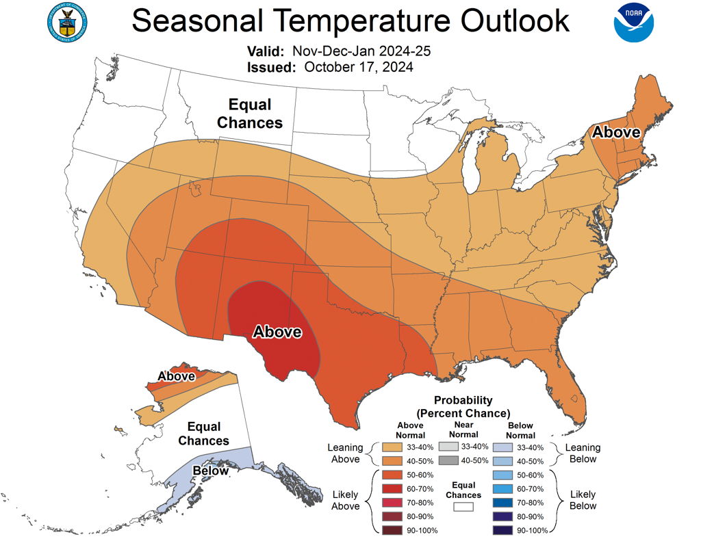
Certainly is looking like a warm Autumn if these forecasts come to pass.
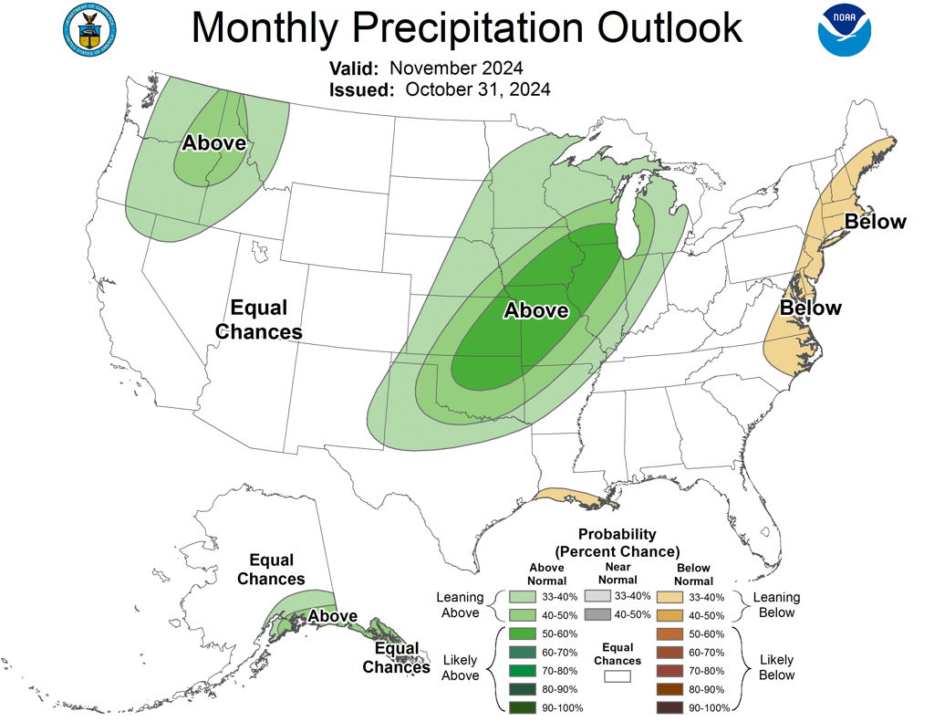
Here are the precipitation predictions of departures from normal for November:
Here is the equivalent graph for November to January:
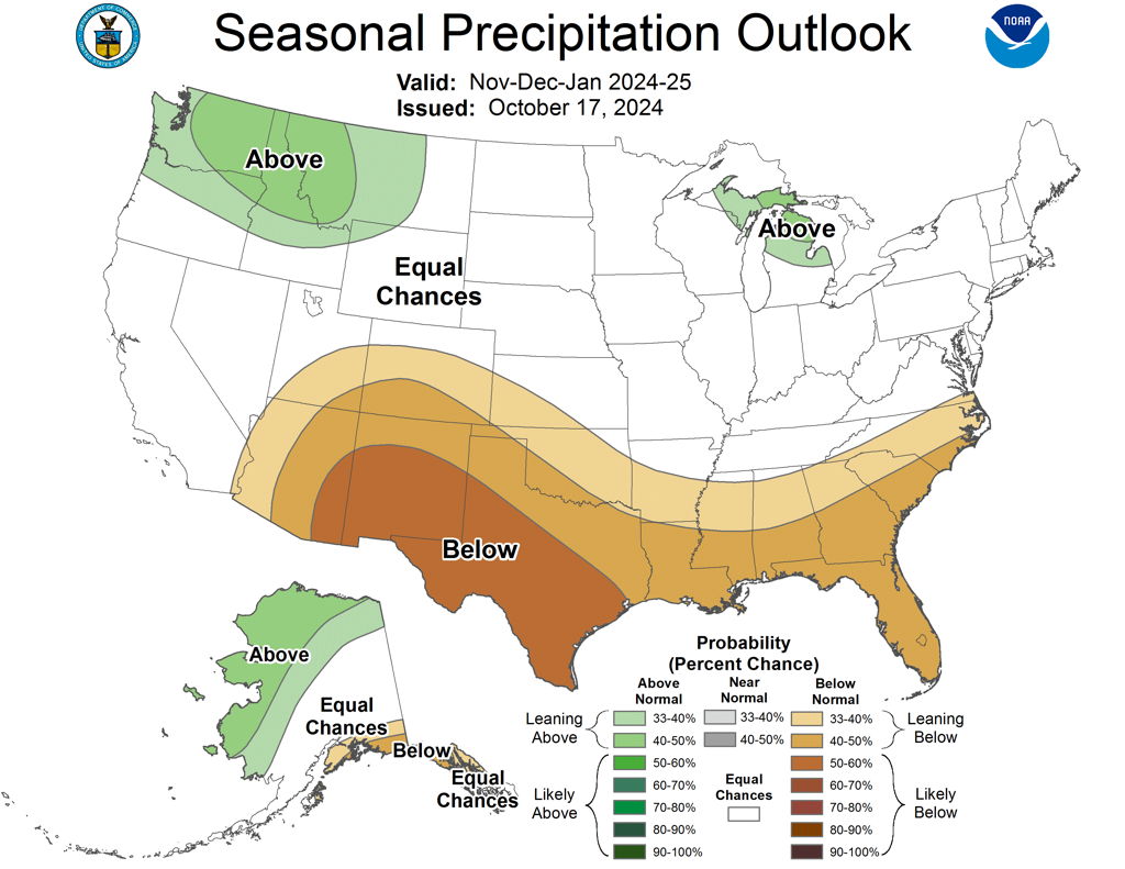
The forecast for November alone seems a bit puzzling. However, the 3-month forecast is consistent with the temperature predictions.
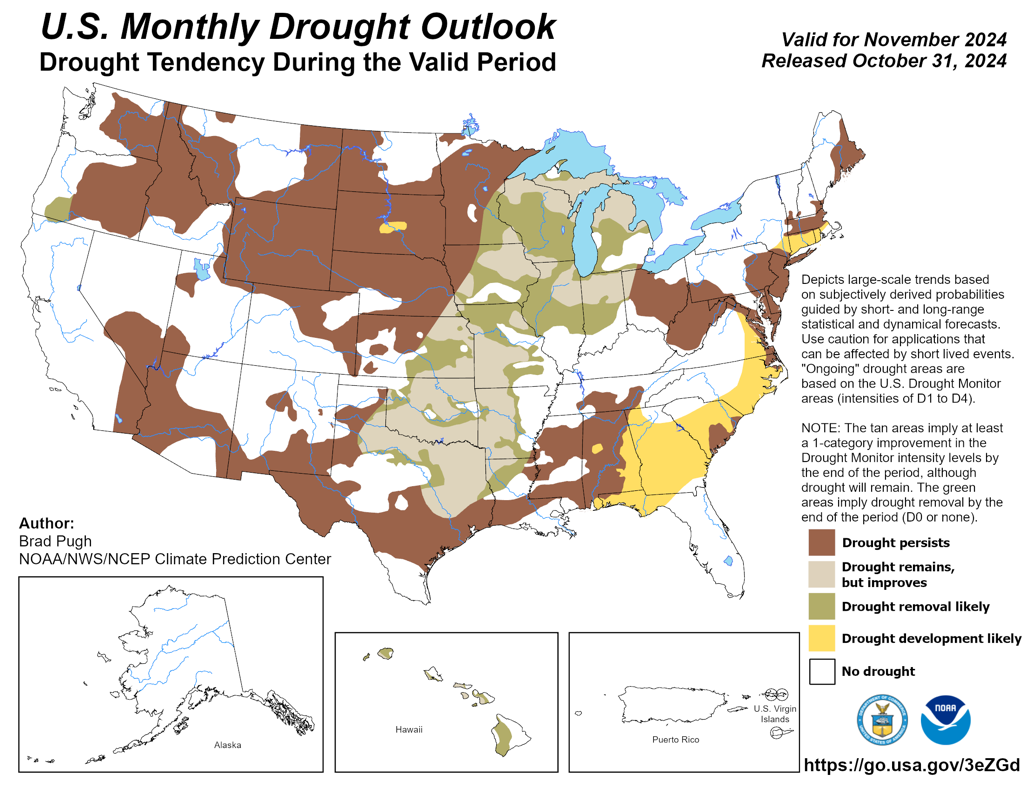
Given the discouraging precipitation forecasts, the drought outlooks are no surprise. Here is the drought outlook for November:
Here is the 3 month outlook:
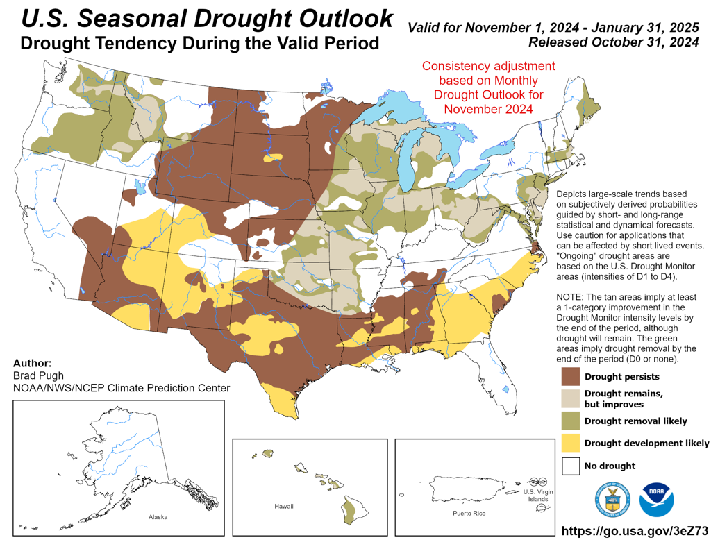
The spread of drought is highlighted in the NOAA winter outlook and is influenced in part by the expected La Niña
Of course the next set of predictions are wildfire threats. These come from the
NICC - National Interagency Coordination Center. As always, these come only monthly. Here is the updated November:
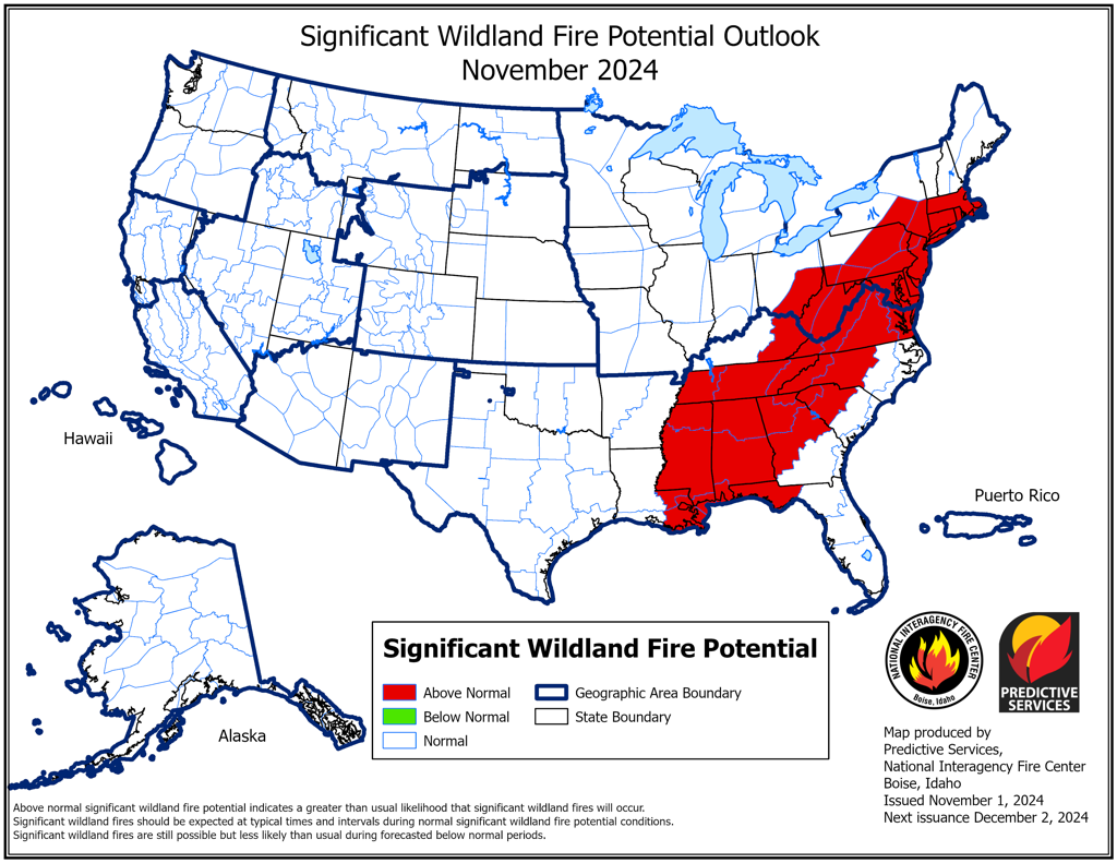
It is certainly less common to have wildfire risk in the eastern 1/3 of the country. Here is the November outlook.
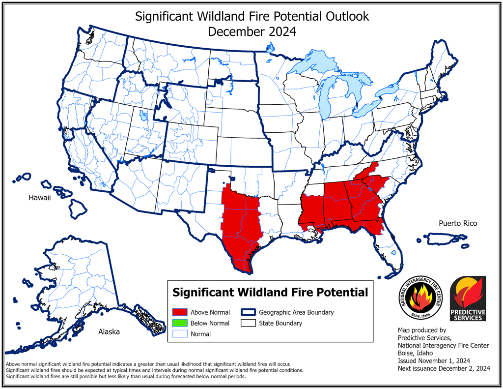
Here is January:
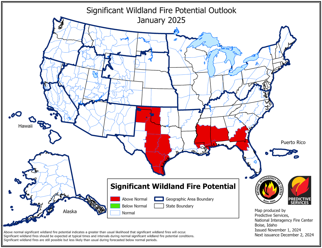
By the time of the transition from autumn to winter, the wildfire risk is to be found in more typical locations which coincide with the expected expansion of drought.
As usual, Like it or not, such are the forecasts we are facing . . . .
Edouard


