Dear WeatherCat climate watchers,
August has arrived and here is the first 1 month and 3 month forecasts from the National Weather Service -
Climate Predication Center for the middle of summer. Here is the one month forecasts of departures from normal temperatures for August:
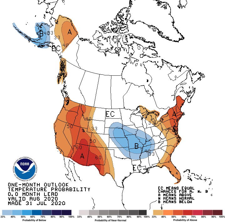
August is expected to be more seasonable in some parts of the country than July was forecast to be. The cooler than normal in the center of the country is a bit puzzling.
Here is the equivalent 3 months predictions of temperatures departures from normal for August through October:
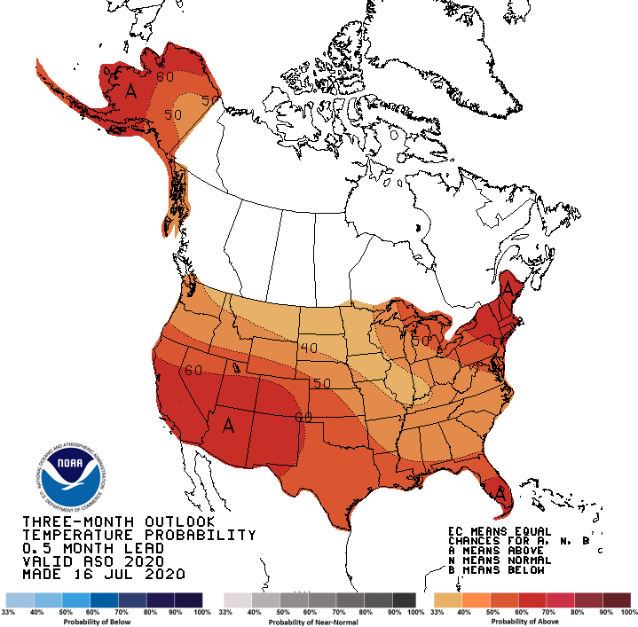
There is also similarities to last month's predication although the forecast is more extreme. It is definitely a
"hot everywhere" sort of outlook.
Here are the precipitation predictions of departures from normal for August:

Unlike last month, there is considerable uncertainty with large parts of the country having an equal chance of above, average, or below normal rainfall.
Here is the equivalent graph for August to October:
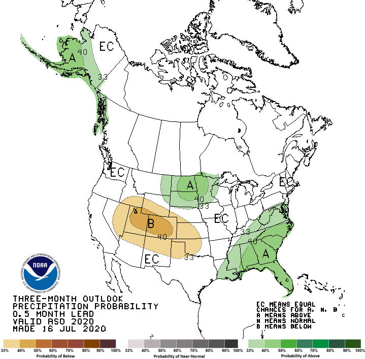
Oddly enough this 3 month graph resembles the 1 month predictions for July!
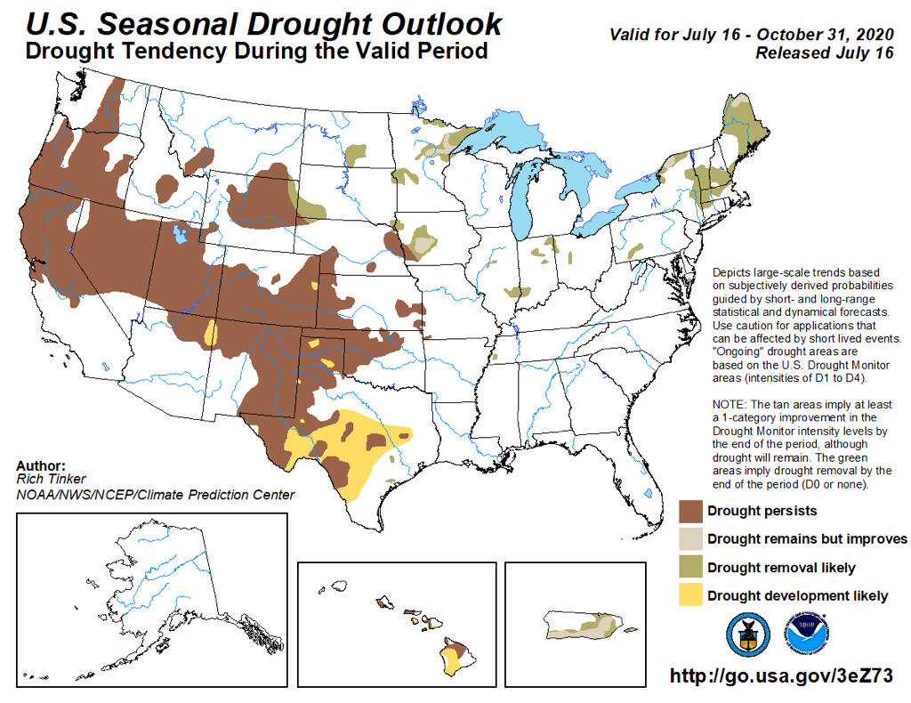
On to drought forecasts. Here is the drought outlook for August:
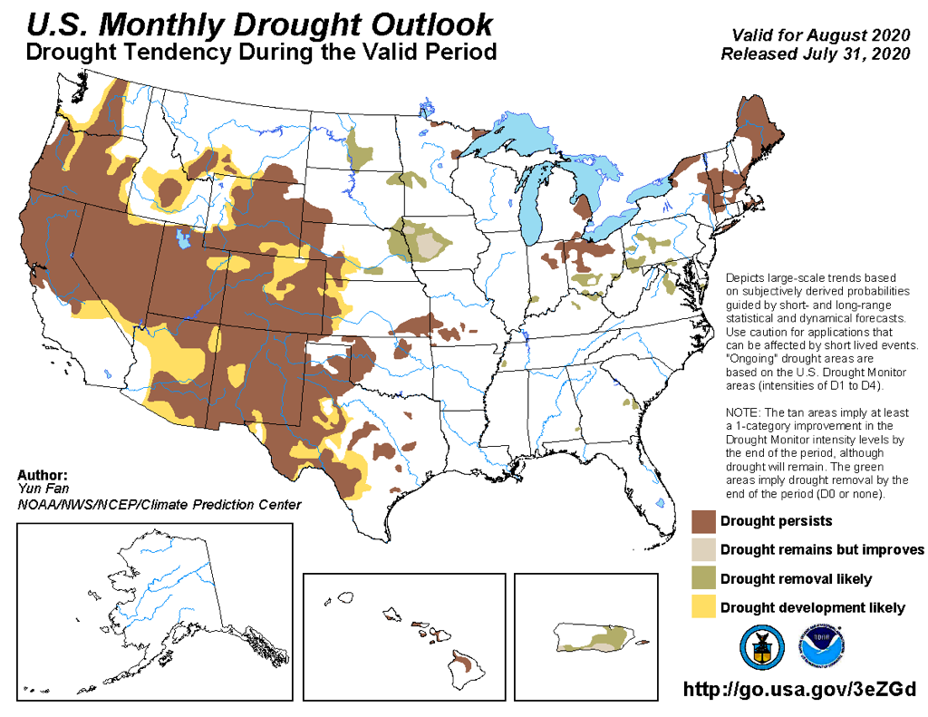
Compared to last month, drought further expands at the edges of already parched territory. Here is the 3 month outlook:
It grimly continues the overall trends of the August forecast although not as extreme. Here are the Wildfire predictions. These come from the
NICC - National Interagency Coordination Center. These come only monthly. Here is the updated August:
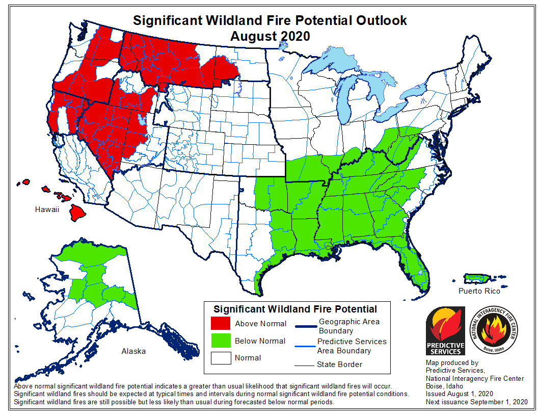
This still shows the Southern parts of the country benefiting from the excessive spring rains. Here is the September outlook.
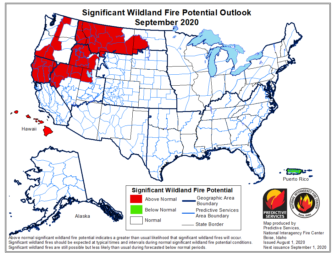
Much of the country finds itself under "normal" conditions of wildfire risk. The exception is a band starting in northern California and stretching east. Here is October:
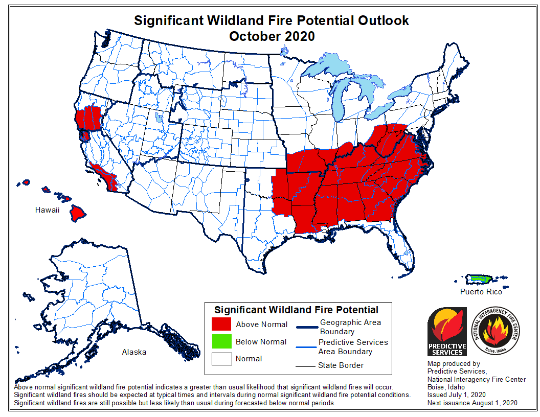
Curiously, much of the threat in the west decreases to "normal." Alas, the San Francisco Bay Area and southern California coast now come under elevated threat. Paradoxically, the areas that were at below normal threat for August are now at an elevated threat for October. I don't see anything in the previous graphs to explain this.
As usual, Like it or not, such are the forecasts we are facing . . . .
Edouard


