Dear WeatherCat climate watchers,
We are the first of March and here is the 1 month and 3 month forecasts from the National Weather Service - Climate Predication Center for the transition from winter to spring. Here is the one month forecasts of departures from normal temperatures for March:
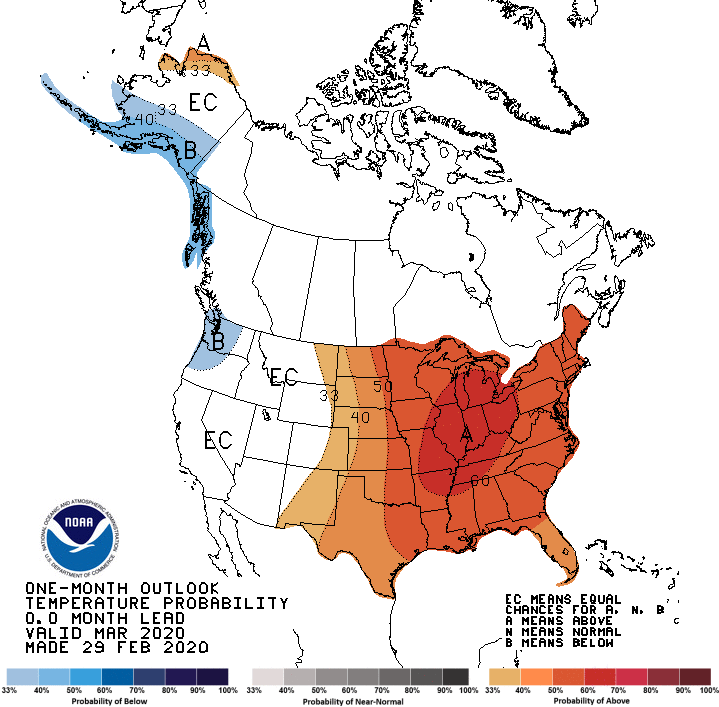
I'm not sure what to make of this purported warmth roughly east of the Rocky Mountains.
Here is the equivalent 3 months predictions of temperatures departures from normal for March through May:
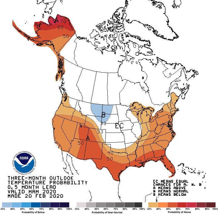
This forecast has the east, south, and west warmer for mysterious reasons.
Here are the precipitation predictions of departures from normal for March:
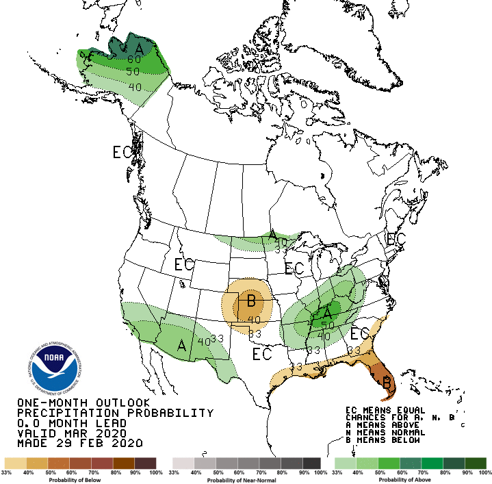
This predication is suggesting equal chance or above normal precipitation for a large part of the county. The two exceptions are almost bull's eye the center of the country and curiously Florida.
Here is the equivalent graph for March to May:
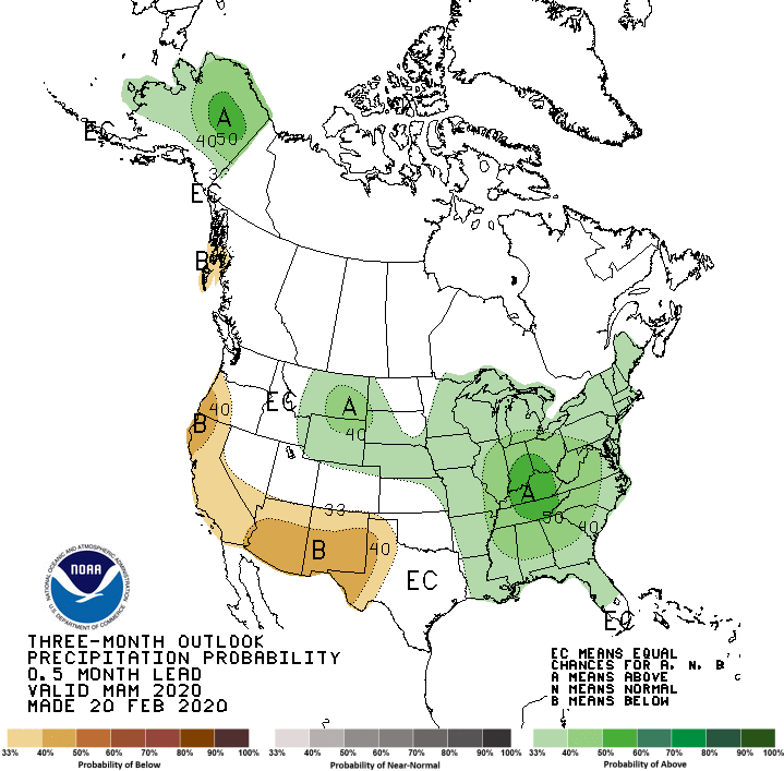
Once more most areas are either equal chance or above normal precipitation. Alas, California and the desert Southwest are expected to fall short.
Here are drought forecasts. Here is the drought outlook for March:

Now much of the west coast is expected to fall into drought. Regions around the 4-corners also suffer along with parts of Texas.
Here is the equivalent 3 month outlook:
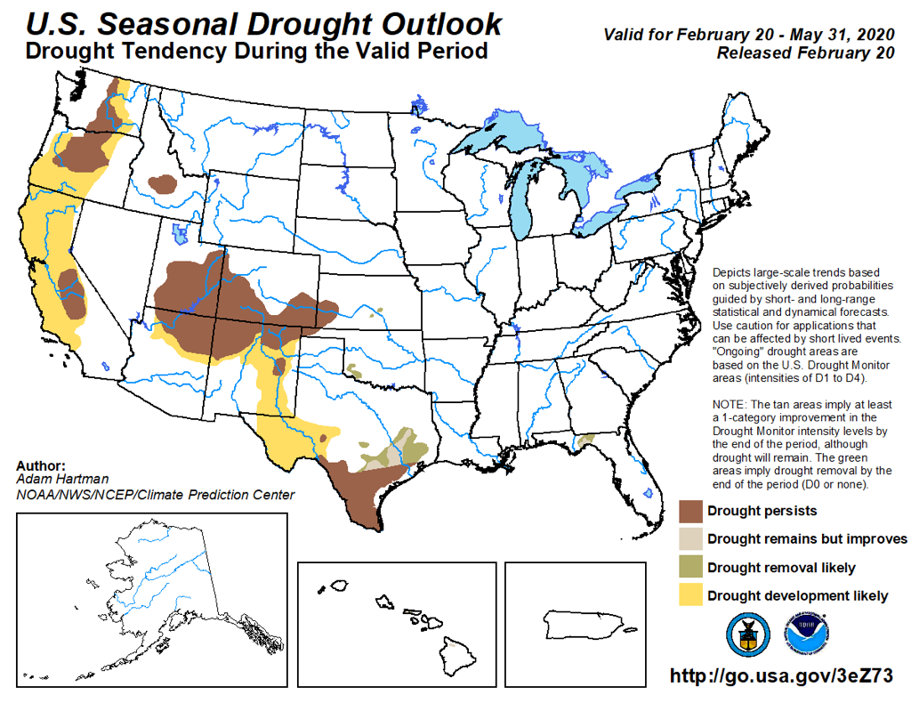
This is similar to the 1 month predication.
Alas, it is clear that the wildfire season is going to start early. Here are the predictions from the National Interagency Fire Center which is part of the
National Interagency Coordination Center. These only come monthly and here is the outlook for March:
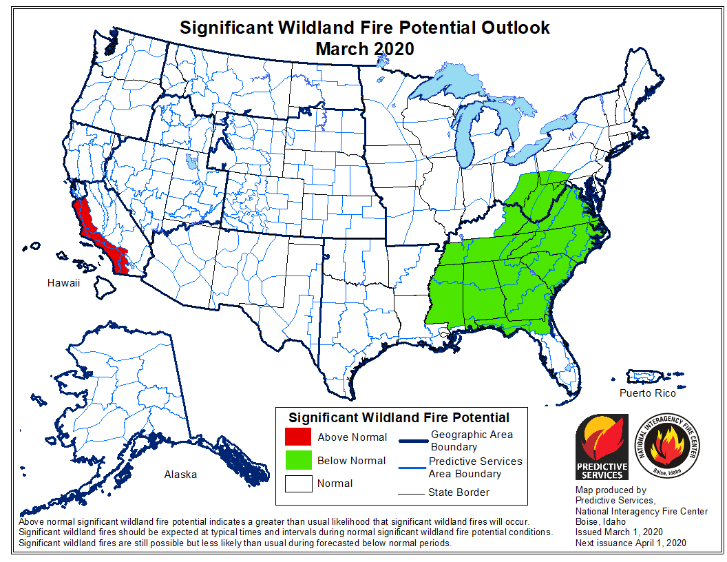
This forecast moves up the wildfire risk in Southern California to March. Here is the April forecast:
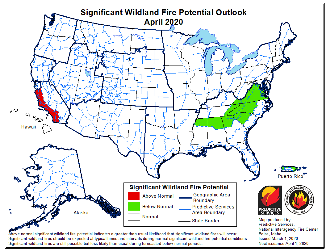
It echoes the March forecast. Here is the May forecast:

Apparently, the seasons turn the risk in Southern California back to the normal category. Finally here is June:
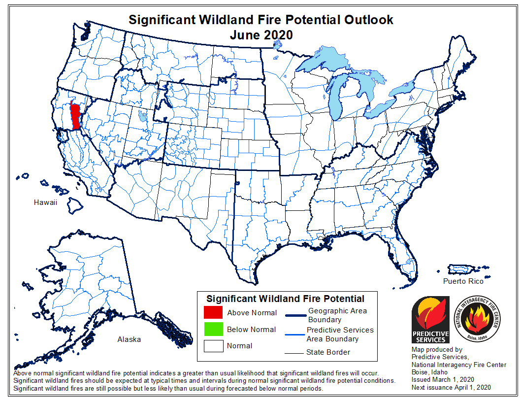
Now it appears the the drier regions to the north of Sacramento face elevated wildfire risks. This could be optimistic considering the wildfire fuel loads around Northern California are closer to June levels than the start of March. It is definitely looking like a dangerous wildfire season for much of the western United States.
As usual, Like it or not, such are the forecasts we are facing . . . .
Edouard


