Dear WeatherCat climate watchers,
Summer is officially underway and here is the first 1 month and 3 month forecasts from the National Weather Service -
Climate Predication Center for the start to summer. Here is the one month forecasts of departures from normal temperatures for July:

It has the same overall pattern as the June forecast, but it appears to capture the strong high pressure centered roughly at the Washington, Oregon, Idaho border. It also predicts another stable high pressure roughly in the New England region.
Here is the equivalent 3 months predictions of temperatures departures from normal for July through September:

This forecast proposes that the high pressure in the 4-corners region will dominate the west. It is definitely a
"hot everywhere" sort of outlook.
Here are the precipitation predictions of departures from normal for July:
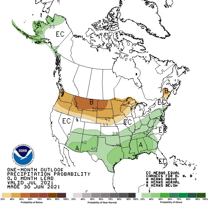
The northern high pressure centers are supposed to reduce rainfall in those areas. The above normal rainfall to the south could have something to do with monsoonal activity.
Here is the equivalent graph for July to September:
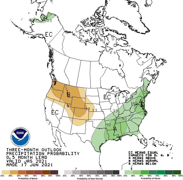
Curiously, the below normal rainfall to the Northwest isn't an obvious consequence of the 4-corners high pressure. The above normal rainfall east of Texas could be a result of a more active hurricane season.
On to drought forecasts. Here is the drought outlook for July:
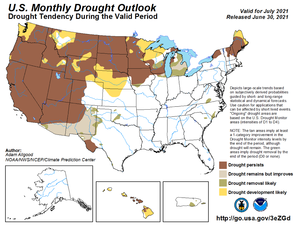
The pattern is consistent with the rainfall forecasts. To the north less rain allows drought areas to expand. In the south, monsoonal rains are expected to provide some relief. Here is the 3 month outlook:

It grimly continues the overall trends of the July forecast.
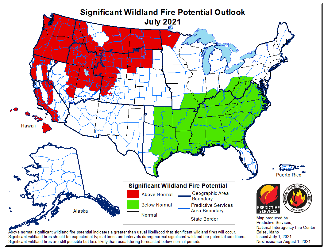
Here are the Wildfire predictions. These come from the
NICC - National Interagency Coordination Center. These come only monthly. They are all very similar so I'll just list all three. Here is the updated July:
Here is the August outlook.

Here is September:
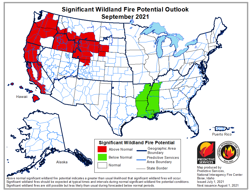
The risk in the West remains mostly constant. I believe the variations are more likely due many areas simply having more or less fire risk as the summer progresses. In the Mississippi river system below average fire risks are expected although this diminishes as finally the rains start to diminish.
As usual, Like it or not, such are the forecasts we are facing . . . .
Edouard


