Dear WeatherCat climate watchers,
August 1st has arrived and here is the 1 month and 3 month forecasts from the National Weather Service - Climate Predication Center for the start of Summer. Here is the one month forecasts of departures from normal temperatures for August:
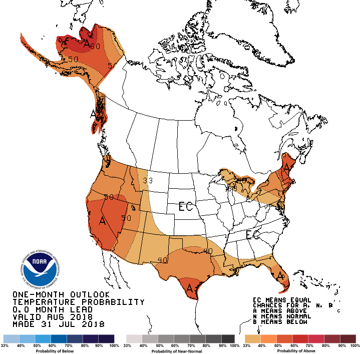
Oddly, this suggests that the high pressure that normally is at the 4-corners region would move into Southern California. That would definitely bad news since July has already seen some of this.
Here is the equivalent 3 months predictions of temperatures departures from normal for August through October:
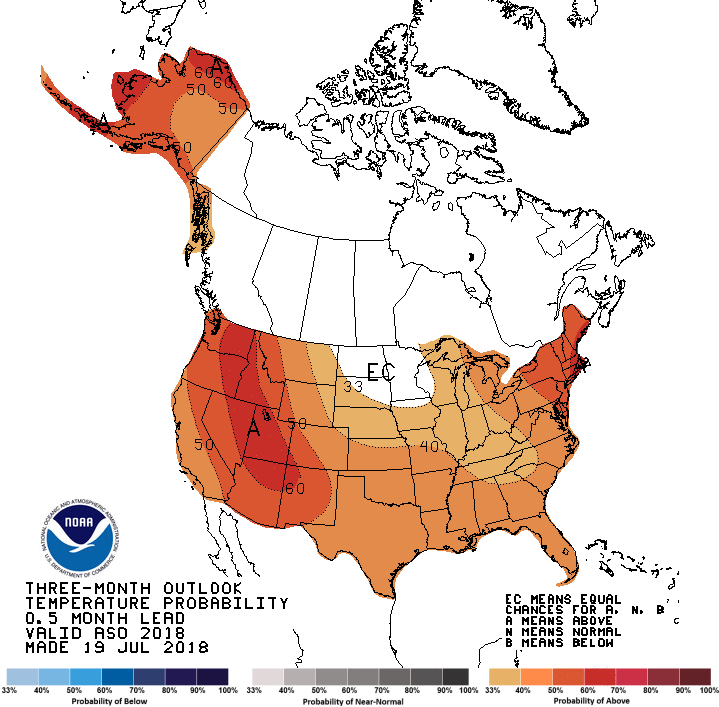
This suggests the same high pressure would move north and back east a bit. That is unusual for that high pressure.
Here are the precipitation predictions of departures from normal for August:
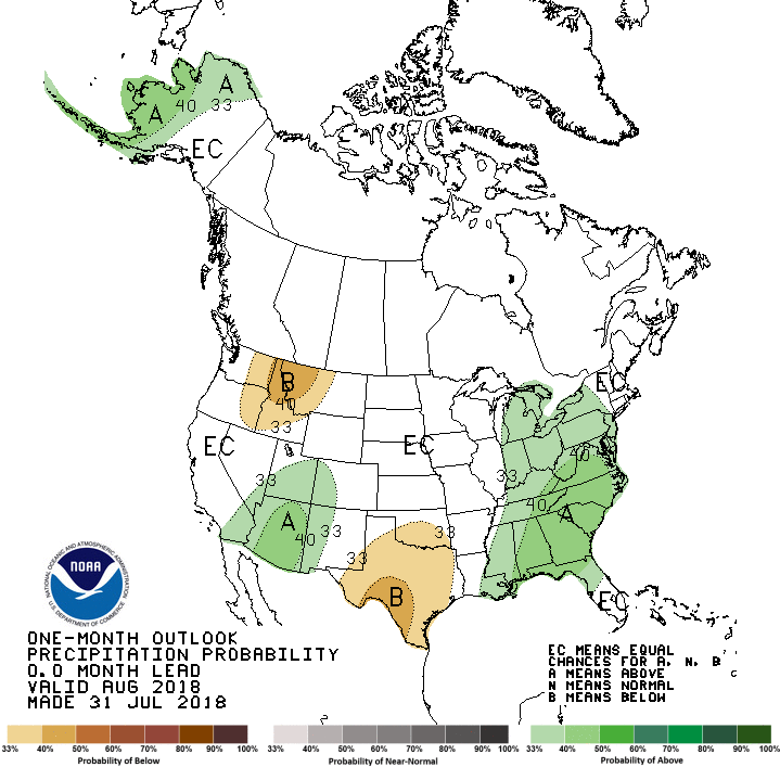
Like last month, it suggests a more active hurricane season both in the Eastern Pacific and the Atlantic. However, last month's forecast didn't really pan out.
Here is the equivalent graph for August to October:
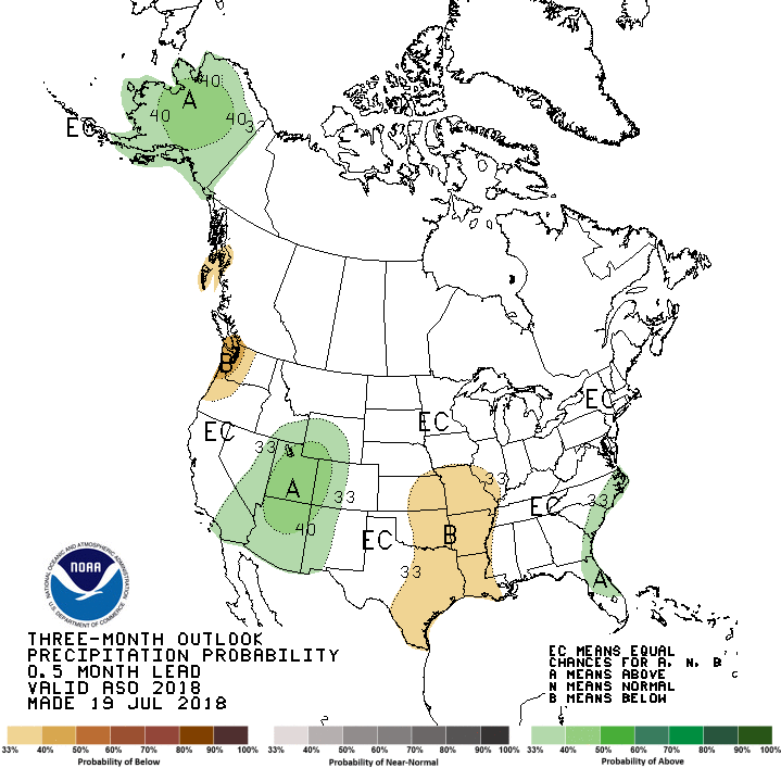
This graph suggests the overall trend of more active hurricane activity would last through the Summer. However, there would be below normal rains in the Pacific Northwest. Once more the question remains whether or not it will indeed occur.
Here are drought forecasts. Here is the drought outlook for August:
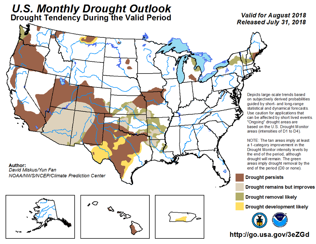
This predication continues to trends of the past 2 months.
Here is the equivalent 3 month outlook:
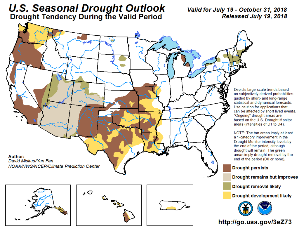
The season outlook suggests that the 4-corners would benefit from the monsoonal rains. On the other hand drought would persist in many areas including Southeastern Oregon. It expands the droughts into Texas and essentially all of Washington state as well. Certainly that is something that does not exactly fit the "Evergreen state."
As usual, Like it or not, such are the forecasts we are facing . . . .
Edouard


