Dear WeatherCat weather watchers,
Those of us in the
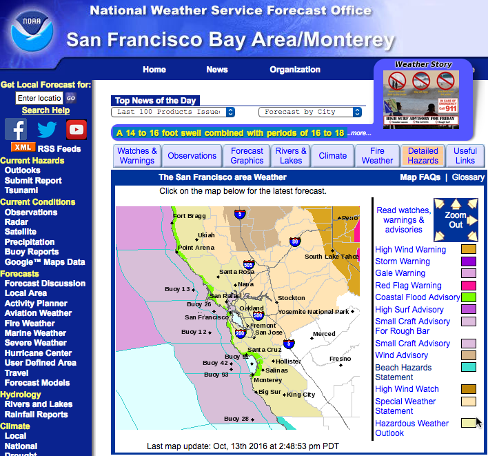
USofA at least may have discovered that a useful way to decide if hazardous weather is headed your way is to see how many colors are on your local National Weather Service bureau page. This afternoon the Monterey page looks like this:
Normally we hope for a few drops as October drags on, but this year will start out differently. The title of today's forecast discussion looks like this:
...POTENT EARLY SEASON STORM SYSTEM TO IMPACT THE REGION FROM LATE
TONIGHT THROUGH THE WEEKEND...
No kiddin' all-caps to make the point that much more loudly. The source of the trouble is a vigorous cold front that is tapping into a moisture plume left over from former Typhoon Songda. The available moisture is close to a record for October. The storm is already causing trouble in the Pacific Northwest of the United States. Rains are expected to be heavy enough and the winds gusty enough to potentially cause damage.
I'm almost finished with my storm preparation. All that's left is to put Rain-X on my collector cone. An event like this - I don't want to miss a single drop!

I do hope this storm will make it way east and help the many other westerners who are suffering from . . . .

Cheers, Edouard
![[cheers1]](https://athena.trixology.com/Smileys/default/food-smiley-004.gif "Cheers")


